Route map of Char Dham Yatra guides you to sacred shrines of Badrinath, Kedarnath, Gangotri, and Yamunotri. Important updates from UTDB, distances from key cities to this spiritual journey of Char Dham Yatra through the majestic Himalayas of Uttarakhand.
Table of Contents
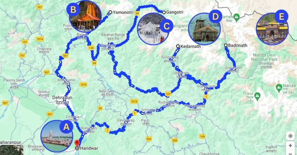
Route Map of Char Dham Yatra by Road
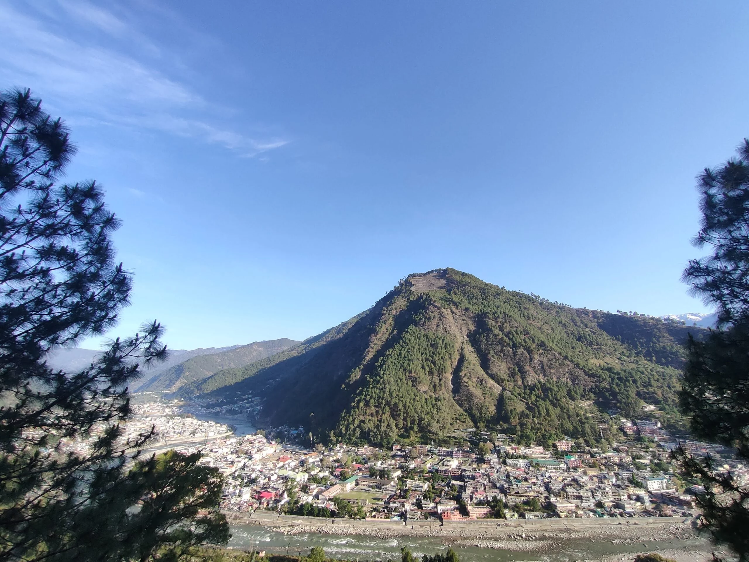
Route map of Char Dham Yatra by road covers approximately 1,600 km, beginning from New Delhi and passing through Yamunotri, Gangotri, Kedarnath, and Badrinath. Key towns like Haridwar, Rishikesh, Barkot, Uttarkashi, Gaurikund, and Joshimath serve as vital transit points along the journey.
Pilgrims can access essential services like fuel stations at Haridwar, Rishikesh, Rudraprayag, and Joshimath, along with ample restroom and vegetarian dining facilities. Local dhabas along the way add charm to the journey, offering regional cuisine and refreshments, making this spiritual expedition both manageable and enriching.
Route Breakdown:
Delhi → Haridwar → Barkot → Yamunotri → Uttarkashi → Gangotri → Kedarnath → Badrinath → Rishikesh → Delhi
| New Delhi – Haridwar (via Meerut, Muzaffarnagar, Roorkee) | 230 Kilometers (4-5 Hours drive) |
| Haridwar – Barkot (Via Mussoorie, Naugaon) | 220 Kilometers (7-9 Hours drive) |
| Barkot – Yamunotri (Via Jankichatti) | 40 Kilometers + 7 Kilometers Trek |
| Barkot – Uttarkashi (Via Dharasu Band) | 100 Kilometers (3-4 Hours drive) |
| Uttarkashi – Gangotri (Via Harsil, Dharali) | 100 Kilometers (3-4 Hours drive) |
| Uttarkashi – Guptkashi (Via Rudraprayag, Ukhimath) | 200 kilometers (7-8 Hours drive) |
| Guptkashi – Kedarnath | 30 Kilometers + 17 Kilometers Trek |
| Guptkashi – Badrinath (Via Rudraprayag, Joshimath) | 190 Kilometers (8-9 Hours drive) |
| Badrinath – Haridwar (Via Joshimath, Rudraprayag, Devprayag) | 300 Kilometers (10-12 Hours drive) |
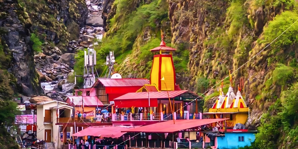
Yamunotri Temple Travel Route
Yamunotri temple travel route begins from New Delhi covering approximately 430 km via Haridwar, Rishikesh, Dehradun, and Barkot before reaching Janki Chatti. A 6 km trek from Janki Chatti takes you to Yamunotri Temple.
The route is well-maintained with fuel stations in Haridwar, Rishikesh, and Barkot. Restrooms and restaurants are available at key stops, including Haridwar, Rishikesh, and Barkot, offering vegetarian meals suitable for pilgrims. Dhabas along the way provide authentic local flavors and refreshments to energize your journey.
| New Delhi – Haridwar (via Meerut, Muzaffarnagar, Roorkee) | 230 Kilometers (4-5 Hours drive) |
| Haridwar – Jankichatti (Via Mussoorie, Barkot) | 220 Kilometers (7-8 Hours drive) |
| Best time to visit | May, June, September & October |
| Yamunotri Temperature | Summer (12°C to 38°C) Winter (-7°C to 10°C) |
| Nearest railway station | Yog Nagri Rishikesh, Haridwar |
| Nearest airport | Jolly Grant Airport, Dehradun |
Driving to Yamunotri Temple ? 5 Key Tips for a Smooth Drive
Road Conditions and Weather:
The roads are steep and winding. Check the weather forecast as monsoons and landslides can cause delays or blockages.
Vehicle Readiness:
Ensure your vehicle is in excellent condition with fully functional brakes, tires, and headlights. Carry an extra fuel can for emergencies.
Permits and Documents:
Keep a valid driving license, vehicle papers, and required permits for entering hill stations.
Essential Supplies:
Carry sufficient water, snacks, first-aid kits, and necessary medications. Trekking shoes and rain gear are vital for the 6 km trek from Janki Chatti.
Early Start and Breaks:
Start early to avoid nighttime driving, and plan regular stops at Barkot or Janki Chatti for rest, refueling, and meals.
Gangotri Temple Travel Route
Gangotri Temple travel route starting from New Delhi covers approximately 482 km via Haridwar, Rishikesh, Dehradun, and Uttarkashi before reaching Gangotri. The route is well-maintained with fuel stations in Haridwar, Rishikesh, and Uttarkashi. Restrooms and restaurants are available at key stops, including Haridwar, Rishikesh, and Uttarkashi, offering vegetarian meals suitable for pilgrims. Dhabas along the way serve authentic local delicacies and refreshments to keep you energized throughout your spiritual journey.
| New Delhi – Haridwar (via Meerut, Muzaffarnagar, Roorkee) | 230 Kilometers (4-5 Hours drive) |
| Haridwar – Uttarkashi (Via Mussoorie, Barkot) | 190 Kilometers (5-6 Hours drive) |
| Uttarkashi – Gangotri Temple (Via Harsil, Dharali) | 97 Kilometers (3-4 Hours) |
| Best time to visit | May, June, September & October |
| Gangotri Temperature | Summer (12°C to 40°C) Winter (-7°C to 10°C) |
| Nearest railway station | Yog Nagri Rishikesh, Haridwar |
| Nearest airport | Jolly Grant Airport, Dehradun |
Driving to Gangotri Temple ? 5 Key Tips for a Smooth Drive
Road Conditions and Weather:
The roads are steep and narrow. Check weather updates as heavy rains or snow can cause roadblocks and landslides.
Vehicle Preparation:
Ensure your vehicle is in excellent condition with properly functioning brakes, tires, and lights. Keep an extra fuel can for emergencies, as fuel stations are limited.
Permits and Documents:
Carry essential documents like your driving license, vehicle papers, and required permits for travel in restricted or forest areas.
Pack Essentials:
Bring adequate water, snacks, a first-aid kit, medications, and warm clothing for cold temperatures near the temple.
Early Start and Breaks:
Start early to avoid night driving in hilly terrain. Plan rest stops in Uttarkashi or Harsil for fuel, food, and restroom facilities.
Read Related Blogs
Top Places to Visit During Char Dham Yatra »

Char Dham Yatra Route Map: Best Road Journey Guide »

Char Dham Yatra Significance: Why It’s a Must-Visit »

Top 6 Travel Tips for a Smooth Char Dham Yatra »

Monsoon Packing Guide for Char Dham Yatra »

Summer Packing Checklist for Char Dham Yatra »

What to Pack for Char Dham Yatra: Essentials Guide »

Char Dham Yatra Budget: How Much Does It Cost? »
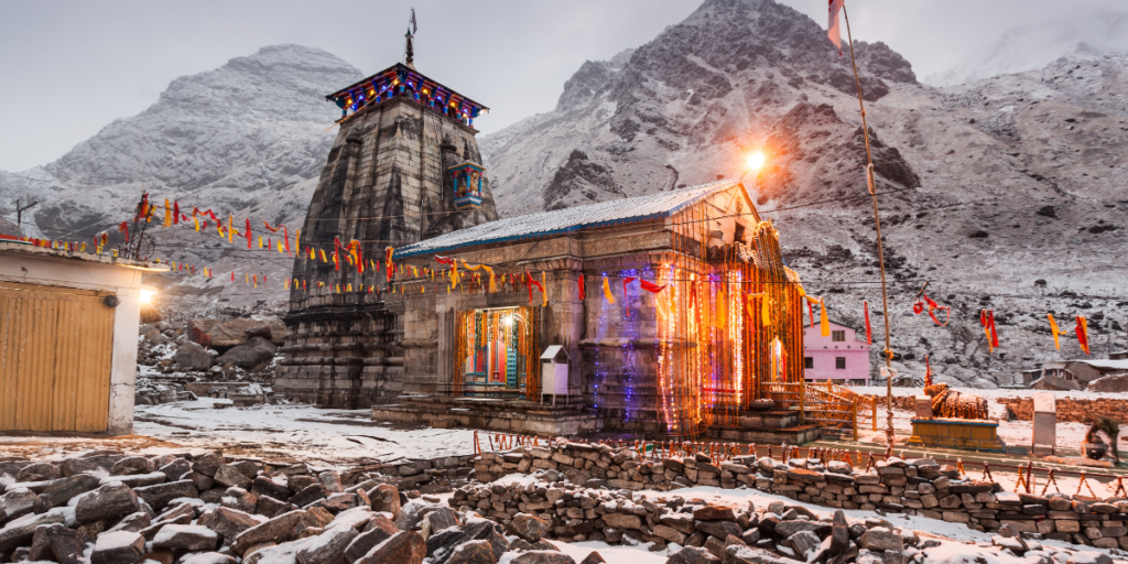
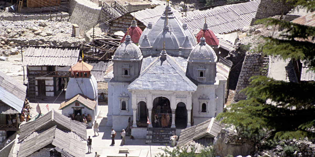
Kedarnath Travel Route
Kedarnath travel route begins from New Delhi covering approximately 450 km via Haridwar, Rishikesh, Devprayag, and Rudraprayag before reaching Gaurikund, the base for the 17 km trek to Kedarnath Temple.
The route is well-maintained with fuel stations in Haridwar, Rishikesh, Srinagar, and Rudraprayag. Restrooms and vegetarian restaurants are available at major stops, including Haridwar, Rishikesh, and Rudraprayag. Small dhabas along the way offer hearty local meals and refreshments, making the challenging journey more comfortable.
| New Delhi – Haridwar (via Meerut, Muzaffarnagar, Roorkee) | 230 Kilometers (4-5 Hours drive) |
| Haridwar – Gaurikund (Via Rishikesh, Rudraprayag, Guptkashi) | 230 Kilometers (7-9 Hours drive) |
| Gaurikund – Kedarnath Temple (Trek Via Gaurikund, Rambara) | 17 Kilometers (3-4 Hours by pony & 8-10 Hours by walk) |
| Best time to visit | May, June, September & October |
| Kedarnath Temperature | Summer (0°C to 14°C) Winter (-7°C to 10°C) |
| Nearest railway station | Yog Nagri Rishikesh, Haridwar |
| Nearest airport | Jolly Grant Airport, Dehradun |
Driving to Kedarnath ? 5 Key Tips for a Comfortable Drive
Road Conditions and Weather:
Roads are steep and prone to landslides during the monsoon. Check weather updates, especially for rainfall and snowfall, to avoid delays or risks.
Vehicle Preparation:
Ensure your vehicle is in top condition with efficient brakes, tires, and headlights. Fuel stations are limited, so refuel at Rudraprayag or Srinagar before heading to Gaurikund.
Permits and Documents:
Carry essential documents such as a valid driving license, vehicle registration papers, and any required travel permits for restricted areas.
Pack Essentials:
Bring warm clothing, rain gear, first-aid supplies, snacks, and adequate water. Prepare trekking essentials if planning the 20 km hike from Gaurikund.
Plan Stops Wisely:
Start early to maximize daylight travel and plan stops at key towns like Haridwar, Rishikesh, or Rudraprayag for restrooms, fuel, and food facilities.
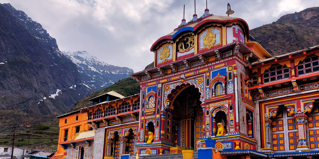
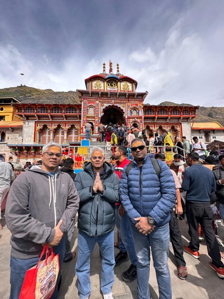
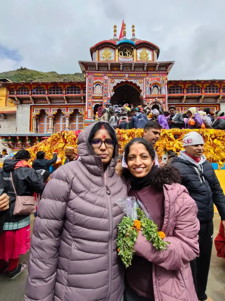
Badrinath Temple Travel Route
Badrinath Temple travel route starts from New Delhi stretching approximately 525 km via Haridwar, Rishikesh, Devprayag, Srinagar, Rudraprayag, and Joshimath, before reaching Badrinath at an altitude of 3,133 meters.
The route is well-connected with fuel stations at Haridwar, Rishikesh, Srinagar, Rudraprayag, and Joshimath. Restrooms and vegetarian dining options are readily available at key stops, including Haridwar, Rishikesh, and Joshimath. Numerous roadside dhabas offer hearty meals and refreshments, making the spiritual journey comfortable and enjoyable.
| New Delhi – Haridwar (via Meerut, Muzaffarnagar, Roorkee) | 230 Kilometers (4-5 Hours drive) |
| Haridwar – Badrinath (Via Rishikesh, Rudraprayag, Joshimath) | 300 Kilometers (10-12 Hours drive) |
| Best time to visit | May, June, September & October |
| Kedarnath Temperature | Summer (0°C to 16°C) Winter (-7°C to 10°C) |
| Nearest railway station | Yog Nagri Rishikesh, Haridwar |
| Nearest airport | Jolly Grant Airport, Dehradun |
Driving to Badrinath ? 5 Key Tips for a Comfortable Drive
Plan Your Route and Stops
The Badrinath Temple travel route from Delhi spans around 535 km via Rishikesh, Devprayag, Rudraprayag, Joshimath, and Mana. Ensure to chart your journey with fuel stations, rest stops, and dining options at key points like Rishikesh and Joshimath.
Weather Check is Essential
The route experiences sudden weather changes, especially during monsoon and winter. Check weather forecasts and road conditions regularly to avoid travel disruptions.
Drive During Daylight
The hilly roads leading to Badrinath can be challenging to navigate after sunset due to poor lighting and steep curves. Start your journey early in the morning and aim to stop at safe locations by nightfall.
Carry Emergency Essentials
Stock your vehicle with snacks, water, first-aid kits, and car repair tools. A portable oxygen cylinder and warm clothing can also be crucial for high-altitude travel.
Know Parking and Trekking Logistics
Parking facilities are available near the temple, but they can get crowded during peak season. If you’re planning short treks around Badrinath, such as to Mana Village or Tapt Kund, wear appropriate footwear and keep trekking gear ready.

Read Related Blogs
Essential Packing Tips for Senior Citizens on Char Dham Yatra »

Char Dham Yatra by Road: Everything You Need to Know Before You Go »

The Ancient Roots of Char Dham Yatra: A Journey Through History »

Char Dham Yatra in Monsoon: Risks, Precautions & Travel Tips »

Char Dham Yatra in Summer: Best Time to Visit & Travel Tips »

How to Book Char Dham Yatra Online: A Step-by-Step Guide »

Char Dham Yatra Peak Season: Best Time, Crowds & Smart Travel Tips »

Char Dham Yatra Road Conditions: What to Expect & Travel Tips »

Emergency Services on Char Dham Yatra Route: Hospitals, Helplines & Safety Tips »